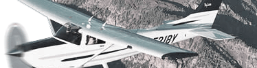
|
AOPA
|
Aircraft Owners and Pilot Association
|
http://www.aopa.org/
|
|
AME
|
Aviation Medical Examiner
|
|
AWW
|
Severe Weather Forecast Alert
|
|
ATPL
|
Airline Transportation Pilot
|
|
AC
|
Advisory Circular
|
|
AIRMET
|
Airmen's Meteorological Information
|
|
AGL
|
Above Ground Level
|
|
ADIZ
|
Air Defense Identification Zones
|
|
ADF
|
Automatic Direction Finder
|
|
ALS
|
Approach Light Systems
|
|
ASOS
|
Automated Surface Observing System
|
|
AWOS
|
Automated Weather Observing System
|
|
ATCT
|
Air Traffic Control Tower
|
|
ARSR
|
Air Route Surveillance Radar
|
|
AIM
|
Aeronautical Information Manual
|
http://www.faa.gov/atpubs/aim/
|
|
AMEL
|
Airplane Multi Engine Land
|
|
AMES
|
Airplane Multi Engine Sea
|
|
ASES
|
Airplane Single Engine Sea
|
|
ASEL
|
Airplane Single Engine Land
|
|
AFM
|
Aircraft Flight Manual
|
|
ARTCC
|
Air Route Traffic Control Center
|
|
A/FD
|
Airport/Facility Directory
|
|
ATIS
|
Automatic Terminal Information Service
|
|
ATC
|
Air Traffic Control
|
|
BFR
|
Biennial Flight Review
|
|
CFI
|
Certified Flight Instructor
|
|
CAT
|
Clear Air Turbulence
|
|
CFII
|
Certified Flight Instructor instrument
|
|
CFIG
|
Certified Flight Instructor Glider
|
|
CFR
|
Code of Federal Regulations
|
|
CPL
|
Commercial Pilot Licence
|
|
CRI
|
Class Rating Instructor
|
|
CAS
|
Calibrated Air Speed
|
|
CDI
|
Course Deviation Indicator
|
|
CTAF
|
Common Traffic Advisory Frequency
|
|
DME
|
Distance Measuring Equipment
|
|
DUATS
|
Direct User Access System
|
http://www.duats.com/
|
|
DVFR
|
Defense Visual Flight Rules
|
|
DF
|
Direction Finder
|
|
ETD
|
Estimated Time of Departure
|
|
ETA
|
Estimated Time of Arrival
|
|
ELT
|
Emergency Locator Transmitter
|
|
EASA
|
European Aviation Safety Agency
|
http://www.easa.eu.int/
|
|
ETE
|
Estimated Time Enroute
|
|
EFAS
|
Enroute Flight Advisory Service
|
|
FBO
|
Fixed Base Operator
|
|
FCC
|
Federal Communications Commission
|
|
FIR
|
Flight Information Region
|
|
FMS
|
Flight Management System
|
|
FA
|
Area Forecast
|
|
FSDO
|
Flight Service Disitrict Office
|
|
FSS
|
Flight Service Station
|
|
FAR
|
Federal Aviation Regulations
|
|
FAA
|
Federal Aviation Authority
|
http://www.faa.gov/
|
|
GPS
|
Global Positioning System
|
|
HIRL
|
High Intensity Runway Lights
|
|
HIWAS
|
Hazardous Inflight Weather Advisory Service
|
|
IM
|
Inner Marker
|
|
IFR
|
Instrument Flight Rules
|
|
ILS
|
Instrument Landing System
|
|
IMC
|
Instrument Metereological Conditions
|
|
IAF
|
Initial Approach Fix
|
|
ICAO
|
International Civil Aviation Organization
|
http://www.icao.int/
|
|
JAR-FCL
|
Joint Aviation Regulations - Flight Crew Licensing
|
|
JAA
|
Joint Aviation Authorities
|
http://www.jaa.nl/
|
|
LLWAS
|
Low Level Wind Shear Alert System
|
|
LOC
|
Localizer
|
|
LIRL
|
Low Intensity Runway Lighting
|
|
LORAN
|
Long Range Navigation
|
|
LAHSO
|
Land and Hold Short Operations
|
|
MOA
|
Military Operations Area
|
|
METAR
|
Aviation Routine Weather Report
|
|
MM
|
Middle Marker
|
|
MEI
|
Multi Engine Instructor
|
|
MOCA
|
Minimum Obstruction Clearance Altitude
|
|
MLS
|
Microwave Landing System
|
|
MSA
|
Minimum Safe Altitudes
|
|
MTR
|
Military Training Route
|
|
MSL
|
Mean Sea Level
|
|
MVA
|
Minimum Vectoring Altitudes
|
|
MIRL
|
Medium Intensity Runway Lights
|
|
NOTAM
|
Notice to Airmen
|
|
NDB
|
Non-Directional Radio Beacon
|
|
NACO
|
National Aeronautical Charting Office
|
http://www.noaa.gov/
|
|
NTSB
|
National Transportation Safety Board
|
http://www.ntsb.gov/
|
|
OAT
|
Outside Air Temperature
|
|
OM
|
Outer Marker
|
|
OBS
|
Omni-bearing Selector
|
|
PPL
|
Private Pilot Licence
|
|
PAPI
|
Precision Approach Path Indicator
|
|
PICUS
|
Pilot in command under supervision
|
|
PIREP
|
Pilot Report
|
|
PAR
|
Precision Approach (Radar)
|
|
PIC
|
Pilot in Command
|
|
RVR
|
Runway Visual Range
|
|
RMI
|
Radio Magnetic Indicator
|
|
RCLS
|
Runway Centerline Lighting
|
|
RNAV
|
Area Navigation
|
|
SIGMET
|
Significant Meteorological Information
|
|
SIC
|
Second in Command
|
|
SID
|
Standard Instrument Departure
|
|
STAR
|
Standard Terminal Arrival
|
|
SAR
|
Search and Rescue
|
|
SVFR
|
Special VFR
|
|
TRSA
|
Terminal Radar Service Area
|
|
TIBS
|
Telephone Information Briefing Service
|
|
TDZL
|
Touchdown Zone Lighting
|
|
TACAN
|
Tactical Air Navigation
|
|
TWEB
|
Transcribed Weather Broadcast
|
|
TAS
|
True Air Speed
|
|
TCAS
|
Traffic Alert and Colission Avoidance System
|
|
VASI
|
Visual Approach Slope Indicator
|
|
VORTAC
|
VHF OmniDirectional Range/Tactical Air Navigation
|
|
VOR
|
very high frequency omni-bearing range
|
|
VOT
|
VHF Omni-Range Test Facility
|
|
VHF
|
Very High Frequency
|
|
VMC
|
Visual Meteorological Conditions
|
|
VFR
|
Visual Flight Rules
|
|
VV
|
Vertical Visibility
|
|
WAC
|
World Aeronautical Chart
|
|
WA
|
Airmet
|
|
WS
|
Sigmet
|